
Argyle Street
View of Halifax's popular downtown entertainment district


View of Halifax's popular downtown entertainment district

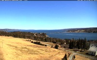
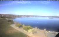
View of the Government Wharf towards Beinn Bhreagh
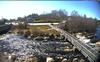
Views of the Barrington River (Kiack Brook) in the historic district of Barrington.
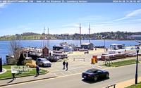
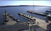
Home port of Bluenose II.
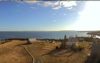
View from the church at the Highland Village Museum

View of Historic Acadian Village of Nova Scotia, looking towards Pubnico harbour.
View from the church at the Highland Village Museum towards Iona and Grand Narrows

from the View Park towards the expanse of dykelands of the World Heritage Site. To the east and west are dykes protecting the active agricultural landscape. The Memorial Church at Grand-Pré National Historic Site can be seen in the middle distance; Long Island is to the north of the dykelands and the cliffs of Blomidon are in the far distance.
Du parc d’observation, voici ce que vous voyez en faisant face au nord et en regardant vers la vaste étendue de terres endiguées du site du patrimoine mondial. Vers l’est et vers l’ouest, les digues qui protègent les terres agricoles exploitées. Au second plan, l’église-souvenir du lieu historique national de Grand-Pré. Long Island se trouve au nord des terres endiguées et les falaises de Blomidon sont en arrière-plan.
Centennial Park, Privateer Park and the Mersey River

View from Visitor Information Center towards Maritime Museum of the Atlantic and Cable Wharf.
View from the roof of the Maritime Museum in various directions.

View of Nova Scotias well-known landmark, the famous Peggys Cove Lighthouse.

View of the cove from the Holy Mackerel gift shop.
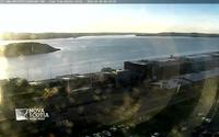
View from the Westin Nova Scotian Hotel to Georges Island, Port Authority, Seaport Farmers Market, Pier 21-22 and McNabs Island.
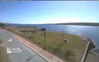
View of Shelburne Waterfront
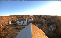
View from the steeple of the St. James Presbyterian Church
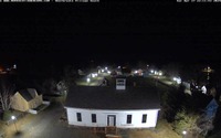
View from the steeple of the St. James Presbyterian Church